
Check out resident-based organizations in the fight against urban blight:
https://savethewasatchbench.org
https://eastbenchslc.files.wordpress.com/2021/01/ebmp-document.pdf
https://sweetstreets.org
https://signthevine.com
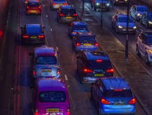
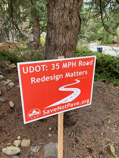
Learn what happens when cities turn residential streets into wider fast-moving roads. This is called a STROAD.
Logical Solutions
- 3-lane maximum. One lane in each direction with center median to improve coming into & leaving intersecting residential streets
- 35 MPH road design
- Traffic calming features
- Round-abouts that keep traffic flowing & allow egress/ingress
- Express bus or BRT (Bus Rapid Transit) & ski bus alternatives
Resources - Read more!
Organizations
Save Not Pave on FB
CWC Central Wasatch Commission
WFRC Wastach Front Regional Council
SLCO Salt Lake County’s ATIP Active Transportation Implementation Plan
Save Our Canyons viewpoint
Excerpts on Salt Lake County’s Wasatch Canyons General Plan:
“We have outlined a few themes that need your advocacy:
- Remind the County that our quality of life, economy and recreation all depend upon the health and vibrancy of the land and water within the Wasatch Range
- Encourage the prioritization of an open space funding stream to acquire high value lands to help recreation and access
- Transition from private, personal vehicle to public transit and bus transit
- Parking and infrastructure should be built outside of canyons in order to preserve canyon environs and efficiently connect visitors to transit hubs for year-round transportation
- Ski area development should only take place within existing ski resort boundaries
- WCGP outcomes should enhance environment, water, habitat protections by upholding or expanding stringent zoning and ordinance for development”
Friends of Alta viewpoint excerpts
“RE UDOT’s EIS 1.4.2 “Importance of S.R. 210 in the Local and Regional Transportation Systems”
Perhaps the biggest disappointment to local residents can be found within this chapter, UDOT designates Wasatch Blvd as a PRINCIPAL ARTERIAL “intended to serve major activity centers and typically have the highest traffic volume and longest trip demands”. This statement puts in doubt all language used by Mr. John Thomas with regards to a new approach by UDOT and being a process that is open to balance the needs of 3 distinct users of Wasatch Blvd. The designation of PRINCIPAL ARTERIAL as described by the Traditional Functional Classification is an interstate freeway; basically giving little or no concessions to the many local demands of this roadway. If Mr. Thomas is sincere in his neighborhood conversations with residents, then it is important to remind UDOT that street designations can fail to consider local context and such designations often fail to deliver the necessary type or roadway development for the diversity and special needs of roadways within an urban setting – and serve only to prioritize rapid automobile traffic rather than seek mobility solutions for ALL users of Wasatch Blvd.
. . . the estimate of the number of trips that begin and end within the boundaries of EIS Wasatch Blvd (Ft. Union and the split to La Caile) segment provides 10,060 daily vehicle trips that ingress or egress Wasatch Blvd or 3.67 million vehicle trip per year (10,060 x 365 = 3,671,900). While travel patterns might differ from recreational to local users, we will use the same ratio UDOT uses to estimate recreational number of visitors of 1.75 passengers per car; at that rate, we get number of 17,605 local residents or 6.43 million local residents that depend on access to move across rather than along Wasatch Blvd at any given day/year; hardly a trivial number. I can hardly imagine that elected officials at the state legislature have given carte blanche to UDOT to eradicate and diminish the quality of life of local residents (Voters) when, as stated by UDOT, these improvements should accommodate for the safety, health, and general welfare of ALL USERS of S.R. 210.
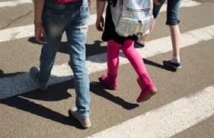
The last group of users studied is bicycle and pedestrians at section 1.4.2.4. Actually, pedestrians within the Wasatch Blvd segment is totally overlooked, not a single word is referenced to this user, and that does not bode well for improvements that will have any measurable impact in promoting safe and convenient walking strategies as a valid form of mobility by people that live in this area. . . Increasing the use of Active transportation among this group of users could prove dramatic relief . . . The FHWA Bikeway Selection guide is clear that a bike lane or shoulder lane is not an adequate facility on urban streets where cars are “travelling at speeds above 30 mph. (Source: FHWA Bikeway Selection Guide, Figure 9: Preferred Bikeway Type for Urban, Urban Core, Suburban and Rural Town Contexts)
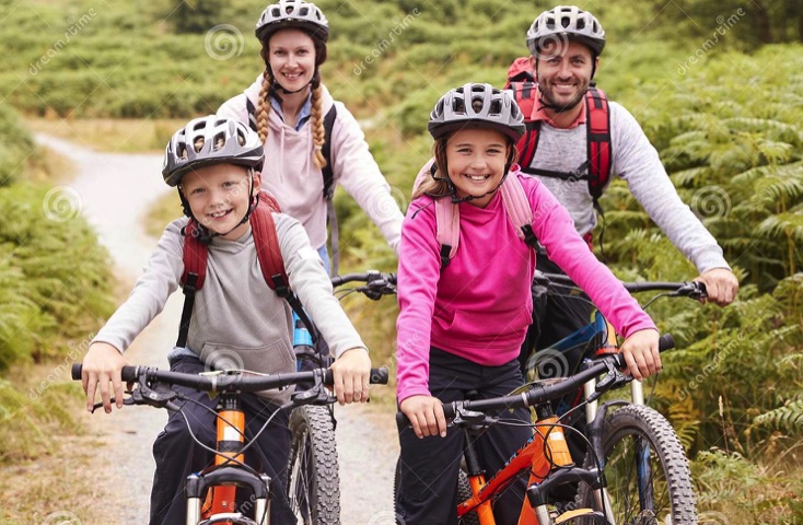
Travel up the canyon by bicycle, once left only to confident, athletic type of riders, might also be a thing of the past due to the availability of e-bikes, and as such all considerations for safety as determined by FHWA guidelines should be considered throughout the entire length of the study area.
1.4.3 Current and Future Transportation System Needs
Mobility: At his point UDOT comes right back to LOS as their single minded goal on how to measure mobility. Failure to determine the amount of single passenger cars, transit, bicycle LOS, pedestrian LOS, etc. shows an inability to view a problem of capacity in its entirety and reverts onto how best fit more cars through a paved road with no interruption. . . Such large expansion of LOS for car travel is likely to induce more people to drive rather than seek other viable options such as car pool, mass transit, active transportation, etc. Also, it should be obvious to UDOT if Alternative mobility options are truly to be desired, then improvements that accomodate LOS level D in 2050 will make it much harder in the 2020’s to shift corridor users to mass transit options.
Safety: speaking of hanging on to old ways. UDOT presents safety statistics through a summary of crash rates from periods of 2010 – 2018 and compares them to state wide averages to determine the safety of a roadway. This is a futile exercise because past experience is a not only a poor predictor of future outcomes, it has no connection to it. . .
Unite for CH Wasatch Blvd promotes the concept of Sustainable Safety, where the use of data can be used to implement rules that minimize, if not eliminate, the probability of serious crashes; defined by UDOT as “a crash resulting in at least one severe injury or a fatality.” Sustainable Safety principles requires the use of Target Speeds for roadways enforced through design that have specific functions; for example, streets where cyclists or pedestrians share the same road the target speed should not exceed 20mph, because at speeds above 20 mph the probability of severe injury (as explained by the law of probability) increases exponentially due to the nature of the crash of a 4,000 pound vehicle against a 180 pound individual travelling at speeds above a “SAFE” threshold. Another example that is applicable at Wasatch blvd is the target design speed of 30 mph where cars meet at 90 degree angles, regardless if they are signalized or not. The reasoning for this principle is the ability of cars to absorb a side impact from another vehicle and provide safety to passengers is greatly diminished once the speed exceeds 30 mph and therefore higher speeds are an unacceptable level of risk to users that will cross Wasatch blvd at 90degrees.
The last paragraph of this chapter is very troubling, it revisits UDOT’s understanding of substandard design elements that as previously stated in this document clearly show a willingness of UDOT to retain high-speed travel along Wasatch Blvd rather than utilize traffic calming elements to slow speeds to levels that provide “SUSTAINABLE SAFETY” to ALL users of Wasatch Blvd. Shoulder width of 8 ft, clear zones of 20 to 22 feet, increased sight distance, and longer deceleration lanes for center lanes – all indicative of high speed environments at the cost of safety to ALL users.”
Data, Diagrams, Studies
Speed-related Crash Fatalities
Petition by Unite for CH Wasatch Blvd, June, 2019
Cottonwood Heights Wasatch Blvd Master Plan diagram
Cottonwood Heights Wastach Blvd Master Plan in entirity
UDOT Revised Little Cottonwood Canyon EIS, Nov, 2019
SLCo’s Wasatch Canyons Master Plan Update, 2019
“The Utah Roadmap” Kem C. Gardner Policy Institute 2019
National Transportation Board Safety Studies
Cottonwood Heights 2018 Resolution supporting Active Transportation
Cottonwood Heights 2019 Resolution to reduce fossil fuels usage
Importance of Slower Speeds
A summary of the NTSB (Nat’l Transportation Board) report’s key findings can be read below:
- Speeding is one of the most common causes of crashes in the U.S. And even so, inconsistent reporting has lead to an underestimation of the full scope of the problem.
- Speeding has few negative social consequences associated with it, and it does not have a leader campaigning to increase public awareness about the issue at the national level. Society under-appreciates the risks of speeding, and the resulting complacency among drivers has led to speeding becoming a common behavior.
- The relationship between speed and crash involvement is complex. In contrast, the relationship between speed and injury severity is direct: Excessive speed both increases the likelihood of a crash, and makes crashes more deadly when they occur.
- Speed cameras are proven to slow speed, save lives. Yet, only 14 states and Washington, DC currently authorize use of Automated Speed Enforcement (ASE). NTSB concludes the lack of state-enabling legislation, and restrictions on the use of ASE have led to under-use of this effective solution. The study urges states to instate enabling legislation and remove restrictions to expand ASE use.
- Common speed setting practices may not be valid and result in unintended consequences. NTSB concludes the original research between speed and safety which purported that the safest travel speed is the 85th percentile speed is dated research and may not be valid. And, the common practice of raising the speed limit to match the 85th percentile speed may lead to higher operating speeds, and hence a higher 85th percentile speed, generating an undesirable cycle of speed escalation and reduced safety. The NTSB Study recommends a safe systems approach to setting speed limits, which factors in crash history and the presence of people walking and bicycling.
Research has found that lowering speed limits can lead to crash reductions in urban areas. Yet, transportation officials often find this safety measure difficult to implement because state transportation department policies emphasize the use of the 85th percentile speed.
(Source Vision Zero Network)
Utah for Responsible Growth
“responsible growth planned at the local level can alleviate problems such as traffic congestion, pollution, lower quality of life, crime”